
Real-time view of the world’s marine traffic
Published on May 27th, 2014
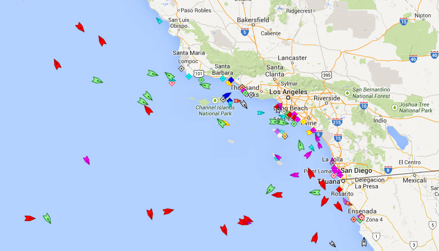
The Marine Traffic project provides free real-time information to the public, about ship movements and ports, mainly across the coast-lines of many countries around the world. The system is based on AIS (Automatic Identification System).
As from December 2004, the International Maritime Organization (IMO) requires all vessels over 299GT to carry an AIS transponder on board, which transmits their position, speed and course, among some other static information, such as vessel’s name, dimensions and voyage details.
Data received are uploaded in the database in real time and therefore they are immediately available on the map and on other pages. However, several positions shown on map may be not continuously refreshed (e.g. when a ship goes out of range). Vessel positions shown on map may be up to 1 hour old. Please note also that map web page is only periodically refreshed or whenever the ‘Refresh now’ link is pressed manually.
Source: http://www.marinetraffic.com/en


Related Posts
American Magic: Checking the boxes →
Coaching change for US SailGP Team →
A rite of passage for SoCal sailors →
 We’ll keep your information safe.