
ABC’s of Navigation
Published on February 8th, 2015
Conrad Colman, now competing in the doublehanded Barcelona World Race, contributes in this report to explain the tools now being used in offshore racing…
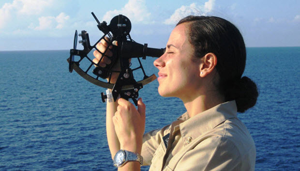
Navigation at sea used to be dominated by the question ‘where are we’ and sailors from Polynesians in canoes to Columbus looked to the sun and the stars for help. But when navigating by star charts and sextant, one could only establish their position once or twice a day in ideal circumstances. In cloudy or inclement weather, the navigator was reduced to “naviguessing”!
Now, our location is given to us by highly accurate GPS several times per second, so the question has changed from ‘where are we’ to ‘where do we need to be in 6 hours or tomorrow in order to go fast’.
We judge time and distance all the time in our everyday lives using our sight and experience of how the world works. In running to catch the bus, we wouldn’t step out to cross the road in front of a speeding Ferrari. But if the next vehicle is a VW camper van with flowers on the sides and Bob Marley wafting from the windows, we know that we’d have time to get across.

At sea this is harder, because we can’t see over the horizon to see if the next weather system is a camper van or a sports car, and our ability to cross the road is defined by the wind direction and strength we have now. In order to catch the bus, in this case a favourable wind, we need help to know more about the coming weather system and also how to define our potential performance of the yacht.
The first part is taken care of by various models of weather forecasts that we download in a format called GRIBS, in which we can choose the zone we are interested in and the relevant time. Since racing yachts very in speed for a given wind strength and point of sail, our computer then has an algorithm in the routing software that looks at the wind we have now and tells us that we can, for example, go 10 knots upwind, 15 knots reaching or 12 knots downwind.
So if you put those two elements together – weather conditions and boat performance – in the routing we can have a pretty good idea of where we can be in any future time given the forecasted wind.
Because the boat goes faster on certain points of sail than others, going from A to B is not as simple as a straight line. For example, when there is a light air bubble of high pressure ahead, it could be faster to sail extra distance around it then to sail the shortest distance through it.
Modern navigation tools provides answers the sextent and paper charts could only dream of.

Related Posts
Technology and offshore racing →
Foilers get electronic boost →
Offshore Tactics: Control what you can →
 We’ll keep your information safe.