
Volvo Ocean Race is Really on Now
Published on October 31st, 2017
British-born meteorologist Libby Greenhalgh, who was navigator for Team SCA in the 2014-15 Volvo Ocean Race, is providing exclusive insight into the current edition for B&G, the official race electronics supplier. Here’s her latest report.

Libby Greenhalgh
Note: This report has been updated since it’s original publish date.
With only seven days to review their first leg, to rest for the next leg, and for some teams to solve boat speed problems, the race is really on now.
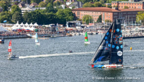
On Sunday 5th November the boats will set off from Lisbon (Portugal) on the first of the big ocean legs which sit back to back. The short gentle sprint from Alicante to Lisbon (1650 nm) may have eased some teams into it, or for others, given a false sense of what it is like.

Now the legs are long, the sailing relentless and the wet, cold southern ocean beckons. If the rest didn’t seem like long enough this time, it is about to be a whole lot harder. It won’t be until Newport (USA) that the teams will feel like they can catch breath as the legs get shorter from there.
The Route
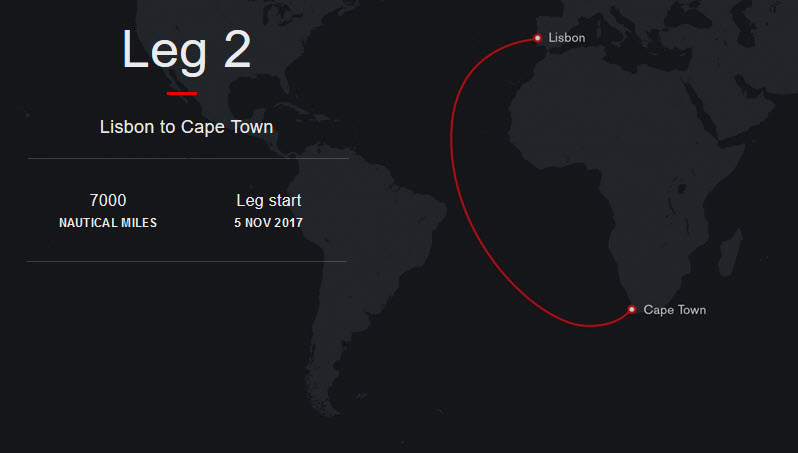
Lisbon to Cape Town (7000 nm) hooking into the trade winds, crossing the doldrums and then heading to the first taste of the Southern Ocean, before arriving at the iconic Table Mountain about three weeks later.
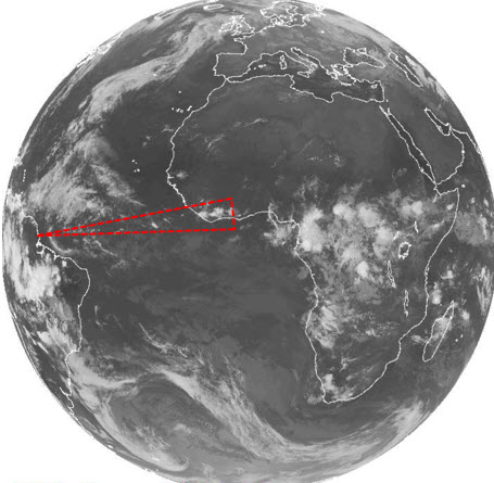
This edition there has been a subtle change in the course. Not just that the leg is starting in Lisbon but that the teams no longer have to leave to port the volcanic archipelago of Fernando de Noronha, which sits about 350 kilometers off Brazil’s northeast coast.
 Instead, they can go straight to Cape Town, which in theory opens up the potential routes to the finish significantly and could see some ‘more out of the box’ thinking with a more easterly route a possibility.
‘Could’ being the key word here, as there are a number of reasons why even without rounding Fernando de Noronha, teams will still be heading that way rather than cutting the corner.
The classic route (shown to right in yellow) covers over 1500 nm more, in distance, than what is drawn on as the shorter more easterly route (shown in white). However, you can also see from this simple schematic some of the large scale weather features that determine the route.
The classic route sets you up in the southern hemisphere with a lot more miles to do, but those miles are all offwind either at your fastest angle or just going fast offwind riding a low pressure system in the southern Atlantic towards the finish. When you can average the same or a little more than wind speed for your boat speed you soon start munching up the miles.
Meanwhile the’ cut the corner’ route will be plodding its way upwind from the Doldrums making for pretty poor VMG. Of the 50 plus routes I calculated with historical data, only 3 routes had the inside corner just ahead or within shouting distance of the classic westerly curve. So you can’t rule it out and I would love to see it but you would be a brave (or foolish) team who takes that on. No one likes going upwind, least of all for 2000+ nm!
Negotiating the weather
Azores High
Typically the Azores high will be sitting off the coast of Portugal, providing a downwind charge towards the equator and setting up a decent NE wind – known as the trade winds. This will allow the boats to charge quickly down towards the Doldrums.
Some acceleration zones can be found around the Canary Islands and the coast of Africa and also around the Cape Verde Islands. Choosing the route through these islands can often be tricky but also quite profitable.
The Doldrums
From the schematic earlier you can see a dotted red triangle which indicates crudely where the Doldrums sit. Known also as the Intertropical Convergence Zone (ITCZ), this area is an uneven band of low pressure, creating deeply unstable conditions in a very slack airflow and therefore large shower clouds that move very slowly. You can see from the schematic that their effect lessens the further west you go, a strategy that will be in every navigators head.
Typically, getting west has always been a key goal on this leg in order to reduce the distance you have to traverse in the doldrums. A metre can mean a mile in the tricky cloud driven conditions. With this leg starting almost a month later than the previous year the opportunity to traverse the Doldrums further east than the usual 26-27deg W becomes more of an option and this is where we will start to see differences in the fleet setup as they take on cloud dodging.
Regularly monitoring the cloud activity in the Doldrums and trying to identify any consistency in width of the zone will help teams determine their approach. Then it will be Radar at the ready to spot the clouds that will make or break them.
 St Helena High
Once King Neptune has gone and the newbies have been initiated across the equator and out of the Doldrums the teams face a second high pressure system known as the St Helena High. This dominates the South Atlantic and the teams will hold to the west of it as they try to dig south to connect with the fast moving low pressure systems to whip them along to Cape Town.
Ice Gates and more
What most people will be talking about before they leave dock will be the Southern Ocean. The’ old saltys’ will be reminiscing about some of their best sailing and skirting over how cold it can be. The newbies will be eager, excited and no doubt nervous.
The sole goal here is to find a big low pressure and ride it to Cape Town. Dropping off a system or behind a front will be the end of your race. So how far you dig south when you just want to go west and head to the finish is sometimes a difficult call and tracker information at this time can be deceptive as to who is in the lead.
The boats will be limited by an ice gate that stops them going any further south than 59 degrees, but we will likely see the teams skirting along this invisible boundary and we will look at this further as the Leg progresses.
That is hopefully a little food for thought as to what the teams are researching and thinking about in terms of longer term strategy. Tune back in on Sunday to get the initial weather outlook for the start of the race. Early signs already show that it’s not normally like this, with an unstable shallow low pressure holding the Azores high further west than normal.
About Libby
A British-born meteorologist, Libby has worked as the meteorologist for the British sailing team across junior and Olympic levels. She is also a freelance weather forecaster working for sailing, surf, kite-surf, bike and car rally events. She has sailed most of her life and competed in the Youth Worlds and 470 class before moving onto bigger boats and match racing.
Race details – Live content – Scoreboard – Race route – Facebook – YouTube
2017-18 Edition: Entered Teams – Skippers
• Team AkzoNobel (NED), Simeon Tienpont (NED)
• Dongfeng Race Team (CHN), Charles Caudrelier (FRA)
• MAPFRE (ESP), Xabi Fernández (ESP)
• Vestas 11th Hour Racing (DEN/USA), Charlie Enright (USA)
• Team Sun Hung Kai/Scallywag (HKG), David Witt (AUS)
• Turn the Tide on Plastic (POR), Dee Caffari (GBR)
• Team Brunel (NED), Bouwe Bekking (NED)
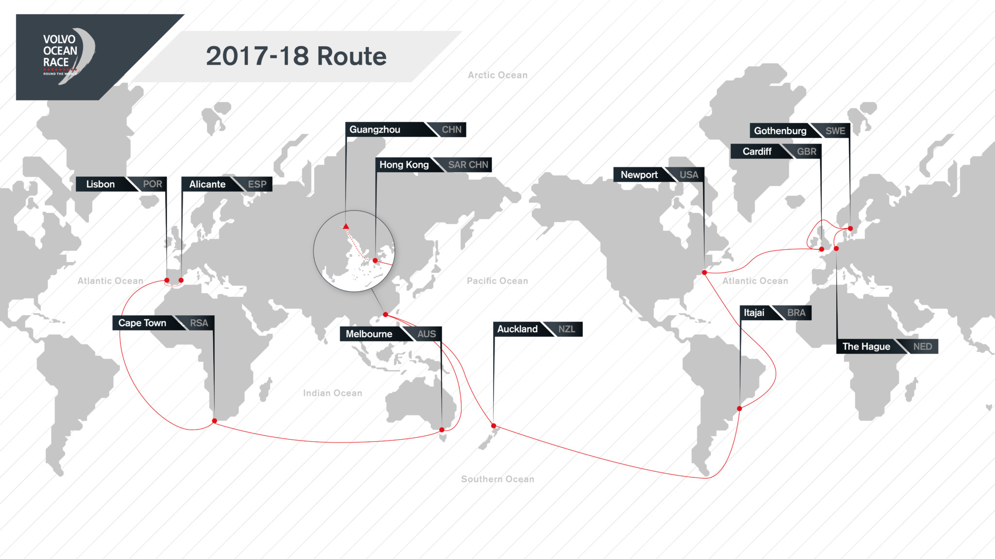
Background: Racing the one design Volvo Ocean 65, the 2017-18 Volvo Ocean Race begins in Alicante, Spain on October 22 2017 with the final finish in The Hague, Netherlands on June 30 2018. In total, the 11-leg race will visit 12 cities in six continents: Alicante, Lisbon, Cape Town, Melbourne, Hong Kong, Guangzhou, Auckland, Itajaí, Newport, Cardiff, Gothenburg, and The Hague. A maximum of eight teams will compete.
Source: Volvo Ocean Race

Related Posts
Pirates in the Indian Ocean →
The Ocean Race Europe begins in Kiel →
Challenges, triumphs, and team spirit →
 We’ll keep your information safe.