
|
|
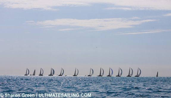
Key West 2010 Key West 2010, presented by Nautica on January 18-22, was the 23rd edition of this prestigious international regatta. For serious racing sailors from across the U.S. and around the world, the focus in January was on the southernmost point of the continental United States - Key West, Florida - where the tropical weather and outstanding race management make this one of the elite events on the world calendar. Scuttlebutt was there too, with this micro-site providing an informational portal for the event. Here are some of the links referred to in the daily reports below: Event website: www.premiere-racing.com Sailing Weather Service updates: http://northsails.sailwx.com T2P.tv nightly on demand video: www.t2p.tv Kattack tracking: www.kattack.com Sailing World reports: http://www.sailingworld.com Scuttlebutt photo gallery: www.sailingscuttlebutt.com/photos Jan. 12 - Jan. 13 - Jan. 14 - Jan. 15 - Jan. 16 - Jan. 17 Jan. 18 - Jan. 19 - Jan. 20 - Jan. 21 - Jan. 22 Tuesday, January 12, 2010 Preparing for the event While mainstream news is reporting the cold snap that has gripped the Florida State, the sailing news is narrowing its focus on its southern most point - Key West. The week before Key West 2010 is all about preparation. Among the 134 entrants, the top teams are either practicing now on-site, or soon will be. Media efforts are also getting organized, and the online spectators should be ramping up too. Scuttlebutt has launched a micro-site to help host the viewer information. Here you will find candid video interviews, random daily comments, and these additional features: Event website The race website already has the class splits, and is known for posting results in near real time. A live blog will fill in the blanks during the racing, with final reports and photos getting uploaded at the end of each day. Sailing Weather Service In partnership with North Sails, SWS is already painting the weather picture for KW2010. Their weather portal is providing live updates that include current Key West conditions, recent Key West observations and a live Local Radar Loop. Once the racing begins, daily forecasts will be posted by 7:30 am ET. Kattack tracking For the J/80 and Melges 32 classes, the Kattack tracking service has provided live viewing players to show the racing as it happens, and will also archive each race for viewing afterwards. This site will host the players and the links to view completed races. T2P.tv Tucker Thompson and his team at T2P.tv will produce a nightly on demand video from each day. Sailing World Here there will be daily reports from correspondents scattered throughout the fleet, interviews with Boat of the Day winners, exclusive photos from Richard Langdon, etc. Sailing Weather Service Provides a Look at the Weather A winter jacket has been more useful than a swimsuit and sunscreen in Key West the past couple of days. In fact, Monday's low of 42 F in Key West was only 1 degree away from breaking the all time record low set 40 years ago. Fortunately, Key West Race Week presented by NAUTICA will not be a frostbite series as temperatures become seasonable in time for racing. The past several weeks have featured a rather consistent weather cycle. The details of this cycle and resulting winds are discussed in earlier articles you should view in the North Sails Weather Center at: na.northsails.com. In summary, this pattern featured a cold frontal passage followed by a high pressure center tracking from the upper Midwest to the southeast U.S. states. Recently this pattern delivered spells of very cold temperatures with strong gusty winds and was capped off by the record cold outbreak of this past weekend. Pre-Race Outlook The typical weather cycle repeats itself the next couple of days�> A cold front crosses Key West Tuesday night followed by a high pressure center tracking from the Plains States to the southeast U.S. However, this time the high does not deliver Arctic air to south Florida, but actually helps warm temperatures. Winds look favorable for practice, if you are already in Key West. Expect a mid to upper teens wind that trends from the northeast on Wednesday to southeast by Friday. A brief interruption in the typical cycle may make practice difficult this weekend� Over the weekend, low pressure is likely to move from the western Gulf of Mexico to the U.S. east coast. This storm brings unsettled weather to Key West and could cause travel headaches for anyone flying through airports on the east coast. Ahead of the storm�'s cold front, a very gusty southeast to southerly wind builds into the low to mid 20s on Saturday. Heavy downpours and thunderstorms are also likely. Following the front, moderate to fresh northwest to northerly winds occur on Sunday as the region begins to dry out. Practice prior to this weekend is advised� The unsettleed weather likely causes unfavorable conditions for practice this weekend, especially on Saturday. The best plan, if possible, is to practice through the remainder of this workweek incase conditions are overly unsettled this weekend. If early practice is not an option, then Sunday afternoon currently looks like the best time to hit the water. Race Week Outlook Racing may kick off with light winds The weather for the race week is becoming clearer but there are still many details to iron out. The pattern of high pressure north of Florida looks to repeat at the beginning of the week. However, the high may be positioned further north, over the Mid-Atlantic States rather than the southeast U.S. Light to moderate winds trending from the north to east are likely if the weather map looks this way at the beginning of the week. These light breezes would cause patchy and shifty conditions that make for tactically challenging races. The weather looks fair with partly to mostly sunny skies, occasional passing showers that cause isolated wind shifts, and seasonable temperatures. Increased winds and unsettled weather possible for late week racing� Details on the second half of the race week remain very inexact at this timeframe. High pressure appears to track east of the U.S. as low pressure develops in the Gulf of Mexico or central U.S. The low moves to the U.S. east coast sending a cold front across Key West. Ahead of the front, winds would veer further into the southeast and become fresh with strong, shifty, gusts. Warmer and more humid air could produce numerous showers that cause localized shifts on the racecourse. A late week frontal passage would cause a period of heavy downpours and thunderstorms followed by northerly winds at fresh to strong speeds. Long Range Wind Forecast Day - Wind Speed - Wind Direction SAT 17-22 SE/SSE SUN 15-20 WNW/NW MON 08-13 NNW/N TUE 07-12 NNE/NE WED 09-14 NE/ENE THU 13-19 ESE/SE FRI 15-21 NNW/N back to top Wednesday, January 13, 2010 Sailing World reports Go to Sailing World (January 13) to read the complete version of the stories below: What to Pack for Key West: All around the United States, sailors are packing their bags for Key West Race Week. Undoubtedly, there are some rookies out there�myself included�scratching their heads about what to bring. To take some of the guesswork out of the task, I polled a few Key West veterans for packing advice... Chuck Allen, tactician, J/80 Rascal: Hi, sailors! Chuck Allen here from North Sails One Design in Rhode Island. I'll be writing daily posts for Sailing World during Race Week. This year, I'll be racing J/80s on the Division 2 circle. We wanted to get involved with the J/80 class, as both the NAs (Marion, Conn.) and the Worlds (Newport, R.I.) take place in the Northeast this year. What better way to get rolling than Key West? (Actually, I started sailing with Steve Kirkpatrick, old college buddy, at Buzzards Bay last season, and we plan to sail in a bunch of events leading up to the big ones. Steve couldn't make Key West, but we thought it would be smart if I went to give some knowledge and a little bit of a head start on things... Terry Hutchinson, tactician, Farr 40 Barking Mad: Well, it's the day before the day before I go to Key West. Looking outside my office in Harwood, Mary., there's a dusting of snow on the ground and my mind is racing to make sure I cover the last-minute details. Don't forget the hand-bearing compass, Sharpie, sunscreen (optimistic), rule book, SIs, NOR, warm clothes�especially this year. A majority of the work has already been done. An 0830 phone call to captain Brad Magosky confirmed that the boat was safely in Key West and a mid-morning conversation with mainsail trimmer Skip Baxter confirmed the sail plan for Thursday's first sail. Thursday will see us cycling through four mainsails, two of which are brand new and will be our mainsails for the 2010 season, one of which is a practice sail, and the final is the one we will use in Race Week... back to top Thursday, January 14, 2010 Preparing for 2010 Review from 2009 Sailing Weather Service Provides an Updated Look at the Weather Key West is finally warming up following a historic cold snap. A familiar weather pattern is also emerging for the race week. The weather pattern is the typical cycle of a cold front passing Key West followed by high pressure near the southeast U.S. The cycle is described in previous outlooks you should consult in the North Sails Weather Center at: na.northsails.com. The weather for the race week is becoming clearer but there are still many details to work out. The typical cycle resets over the weekend as a strong storm moves out of the Gulf of Mexico and a cold front passes Key West causing fresh to strong winds. High pressure over the southeast U.S. follows for the start of the race week bringing light to moderate air to Key West. Another storm in the central U.S. and a cold front crossing Key West may bring increased wind speeds for the second half of the race week. Pre-Race Outlook Practice Friday if Possible High pressure moves east of the Carolinas as low pressure develops in the western Gulf of Mexico. The pressure gradient tightens causing wind speeds to increase. Conditions will not be ideal but they look better than during much of the weekend. Winds build from 13-18 kts to 15-20 kts from the ESE/SE. Expect a shifty flow and unstable wind speeds as gusty right shifts progressively lead to higher mean wind speeds. Temperatures will be seasonable under mainly overcast skies with isolated showers that cause localized wind gusts and shifts. A Small Craft Advisory may be hoisted for later in the day so the earlier you hit the water the better. Unsettled Weather and Fresh to Strong Winds this Weekend� A strengthening centerr of low pressure tracks from the western Gulf of Mexico to the Virginias over the weekend. On Saturday, the wind blows from the SE/SSE at 15-20 kts and will increase to 18-23 kts if the low appreciably strengthens. Temperatures warm to the upper 70s F and humid air touches off intermittent showers and thunderstorms. The lows associated cold front sweeps across Key West late Saturday to early Sunday. The front shifts the wind abruptly right and likely drives a strong squall line across Key West. Expect winds from the WNW/NW at 15-20 kts for much of Sunday. If the front sweeps across Key West very early on Sunday then easing winds and clearing skies are possible by late in the day. The best times for practice this weekend currently appear to be early Saturday and late Sunday. However, high winds and choppy seas likely prompt a Small Craft Advisory for much of the weekend. Race Week Outlook Racing In Light Air� Holding true to the typical January weather cycle, high pressure moves into the southeast U.S. following the weekend low pressure center. The high appears weak, meaning a slack pressure gradient and light air in south Florida. Wind speeds for Key West look light, mainly 08-13 kts on Monday and Tuesday then increasing to 10-15 kts for Wednesday. A slightly stronger high could mean increased wind speeds but anything higher than the mid teens appears unlikely at this time. The high tracks east from near the Gulf of Mexico to the Atlantic veering winds from the N/NNE on Monday to NE by Tuesday and ENE/E on Wednesday. Identifying local shifts and breezes will be critical for a good performance in such light air so expect challenging and competitive races. Fortunately, the cold air will not return as temperatures warm into the low 70s F under partly to mostly sunny skies and mainly dry conditions. Increased winds and Unsettled Weather Remain Possible for Late Week Racing Details on the second half of the race week remain uncertain at timeframe. There are indications that low pressure will develop in the central U.S. or near the Gulf of Mexico on Thursday. The wind in Key West could build into the mid teens and veer to the SE while becoming gusty and shifty. Also, expect increased clouds and the threat of showers and thunderstorms. A cold front associated with the low may sweep across Key West on Friday with squalls and winds shifting to the northwest at fresh speeds. Long Range Wind Forecast Day - Wind Speed - Wind Direction FRI 14-19 ESE/SE SAT 17-22 SE/SSE SUN 16-21 W/WNW MON 07-12 N/NNE TUE 08-13 NNE/NE WED 10-15 ENE/E THU 13-18 ESE/SE FRI 14-19 WNW/NW back to top Friday, January 15, 2010 There's Not A Whole Lotta Runway for the Fling By SW Racing Editor, Peter Isler Heading down to Key West brings back many great memories. The venue, both on the water and shoreside is one of the best there is. And I have plenty of sea stories from that tiny island that are still fresh years later. Like the time when we were training before a J/24 midwinter regatta and picked up a guy swimming well offshore. His name was "Will" and his intended destination was Cuba - until we "rescued" him. Or the time Jimmy Buffet walked by our boat (the IOR 50 Locura) and asked me for help putting a crew together so he could enter his boat (a classic woodie). The wives and girlfriends from our crew were eager to oblige Go to Sailing World (January 15) to read the complete story. Key West Heating Up � Race Week Begins Monday World Class Competition on Tap Key West, Fla - Sailors from around the world are arriving in Key West and preparing to race in North America�s premiere annual international regatta � Key West 2010, presented by Nautica. The cold snap that has gripped much of the country, and even dropped Key West temperatures into the low 40�s, is past tense as temperatures rise with balmy conditions on tap for the weekend practice sessions and racing in the early part of the week. Key West�s dependable breezes and warm waters will be welcome news for crews from over 14 countries and 20 states. The five days of intense competition begins on Monday, January 18th. IRC, PHRF and one design boats will race in three divisions. Grand Prix headliners include the Farr 40 and Melges 32 fleets. The turnout for both classes is up from last year, with an impressive roster of Olympians, America�s Cup and World Champions in the mix. They will be joined on Division 1 by two IRC classes. IRC entrants range in size from 40 feet to Irvine Laidlaw�s Wally 82 foot Highland Fling XI. -- Read on back to top Saturday, January 16 Sailing Weather Service Forecast Sponsored by North Sails & Southern Spars 2010 Key West Race Week � Outlook Forecast Issued 0700 LT 16 January 2009 OVERVIEW SYNOPSIS: Challenging conditions will greet those practicing this weekend. Low pressure currently in the central Gulf of Mexico strengthens appreciably while tracking to New England by Monday. The low significantly tightens the pressure gradient and causes a fresh to strong wind that veers from the SE/SSE today to SW tomorrow. This flow funnels warm and humid air into the region, touching off isolated showers and thunderstorms. A squall line with stronger showers and thunderstorms is possible Sunday afternoon or evening as the low�s cold front sweeps across Key West. The front shifts winds abruptly right in the afternoon, to the WNW/NW, and speeds begin easing. Racing kicks off on Monday with the front dying south of Key West as weak high pressure builds over the central Gulf of Mexico States. Sailors that have read the previous outlooks issued by the North Sails Weather Center know this pattern is the start of the typical Key West weather cycle. In this instance, the high pressure center looks rather weak, meaning a slack pressure gradient across the Keys. Winds on Monday come from the N/NNE at only 10-15 kts. The lightest air looks likely on Tuesday when the high moves north of Florida and winds ease to 08-13 kts from the NE/ENE. Slight recovery to 10-15 kts from the ENE/ESE is possible Wednesday as the high drifts into the Atlantic. Temperatures will be seasonable and skies a varying mix of sunshine and clouds during these first three days. Nailing down the fine details for the second half of the race week is difficult at this time. However, weather models continue to suggest low pressure near the southeast U.S. on Thursday and a cold front crossing Key West by Friday. This scenario is also in line with the typical Key West weather cycle and would mean higher winds. SE�ly winds likely strengthen from the mid to upper teens on Thursday if low pressure is in the southeast U.S. A fontal passage on Friday would shift a fresh S�ly flow to a moderate NW wind. Temperatures remain mild but showers and thunderstorms become more abundant, especially with any frontal passage. *************************************************************** OUTLOOK FOR SATURDAY (16 January 2010) SYNOPSIS: Low pressure in the central Gulf of Mexico this morning tracks to the Florida Panhandle by the evening. The low causes an 18-23 kt wind from the ESE/SE this morning. Winds may ease slight during the afternoon, to 15-20 kts, in conjunction with a right trend to the SE/SSE. Through the day, expect strong right shifted gusts. Gusts may become more frequent and intense this afternoon, reaching the mid to upper 20s, despite any easing of mean wind speeds. If you are looking for the lightest winds stay very close to the Keys in the cooler waters. The water near the Keys, and especially on the Gulf side, is abnormally cool for this time of year. The colder water is cooling the air near the surface and causing winds to be slightly lighter and backed over these waters. Detailed Wind Forecast: Time Wind Speed Wind Direction (LT) Mean Range Mean Range 1000 20 18-23 130 110-155 ...right shifted gusts to 25-30 kts today 1200 19 17-22 135 115-160 ...slight right trend in AM, faster PM 1400 18 16-21 145 120-165 ...speeds may decline slightly in PM 1600 17 15-20 155 130-175 ...but gusts more frequent/intense in PM SEAS: Nearshore 2-3 ft (0.5-1m) with moderate to heavy chop. Further offshore (near Sand Key) 4-7 ft (1.25-2.0m) at a period of 5-6 seconds from the ESE/SE. WEATHER: Mild and humid with a high in the upper 70s F (25C) and only cooling to the low 70s F (22C) at night. Varying clouds with the chance of an isolated shower. back to top Sunday, January 17 Daily event report from Premiere Racing Travelling to KW2010 Preview by Dave Ullman Panel Discussion OUTLOOK FOR SUNDAY (17 January 2010) SYNOPSIS: Low pressure moves north of Florida to the Carolinas. A fresh wind is maintained in the Keys as the low�s cold front approaches from the NW. Winds increase from the mid to upper teens and veer from the S to SW as the front approaches. The front currently looks to sweep across Key West late in the afternoon. Expect a wind surge just before the front then an abrupt right shift and eventual easing behind the front. Gusts into the low to mid 20s become more intense and right shifted as the front approaches. Detailed Wind Forecast: Time Wind Speed Wind Direction (LT) Mean Range Mean Range 1000 17 14-19 200 180-225 ...large right shifted gusts 20-25 kts 1200 18 15-20 215 195-245 ...speeds increase as front approaches 1400 19 16-22 235 210-265 ...faster right trend as front approaches 1600 17 14-20 280 250-305 ...abrupt right shift at frontal passage back to top Monday, January 18 Daily event report from Premiere Racing Event results Kattack tracking replay of J/80 and Melges 32 races 1 and 2. 

Click here for photo gallery Peter Craig, Premiere Racing - Event manager Scoring - Behind the scenes Live updating - Behind the scenes Key West celebration Boat of the Day: Melges 24 Uka Uka As the first major regatta of the year, Key West Race Week is where many teams come to bring themselves up to speed. On the other hand, for teams that are already in competitive form, the first day of the event presents a prime opportunity to kick some butt. That's precisely what Lorenzo Santini's Uka Uka team did in the Melges 24 class today. The Italian team�which also includes SW contributor and Seattle resident Jonathan McKee calling tactics�jumped out of the gate with a pair of excellent finishes and earned Boat of the Day honors. The 21-boat Melges 24 class is smaller than in years past�likely because last October's Melges 24 Worlds in Annapolis busted many teams' travel budgets�but winning it won't be a cakewalk. Several contenders from the Worlds, including Franco Rossini's Blu Moon and Alan Field's WTF, made the trek to Key West. Uka Uka finished sixth in Annapolis. Since then, the team has incorporated a new bowman, Fabio Brinelli, but that hasn't slowed them down. "We sailed so much before the Worlds, and it wasn't that long ago," says McKee. "We really weren't rusty today at all." In both races, a pack of four or five boats separated from the rest of the fleet. "The first finish was just awesome," says McKee, "We all arrived at exactly the same time." Blu Moon edged out Uka Uka to win the first race; in the second race, Santini's team had a lousy start. "We got stuck behind a pack of boats," he says. "But we came back alright. (They came back more than alright�they won.) We are very happy for the regatta so far. It seems we are just fast." The key to Uka Uka's speed could very well be the nourishment provided by team chef Marco Corfortoli. After picking up their Boat of the Day award, the gang was headed back to their lodging to feast on Chianina, an Italian steak Corfortoli was preparing. "It's not from America," he says. "It's from Italy. It's better." Corfortoli was talking about beef, but he may as well have been talking about his team. At this point in the game, Uka Uka is simply better. - Michael Lovett, Sailing Worlds Read additional reports from Chuck Allen, Terry Hutchinson, Jonathan McKee, and Dave Reed from Monday here at http://www.sailingworld.com Sailing Weather Service Forecast Sponsored by North Sails & Southern Spars 2010 Key West Race Week � Race Day Forecast Issued 0700 LT 18 January 2010 WARNINGS AND ADVISORIES: No warnings or advisories are currently in effect. However, please monitor NOAA All Hazards Radio on your VHF for the latest official warnings and advisories from The National Weather Service. FEEDBACK: Sailing Weather Service and North Sails encourage feedback. Even a few observations from the racecourse can greatly clear up our understanding of the day�s weather. When able, please send us daily weather notes so we can improve YOUR forecast at: feedback@sailwx.com. Thanks! KEY WEST WEATHER PORTAL: In addition to this forecast, North Sails and Southern Spars are sponsoring a special Key West Weather portal supported by Sailing Weather Service (SWS). Use the portal to view SWS high resolution wind models, obtain GRIBS for racing software, and much more! Also be sure to monitor the portals BLOG during the race day for live weather updates from SWS meteorologists. Access the portal through na.nortsails.com or directly at northsails.sailwx.com. There is also a version enabled for mobile devices at wapnorthsails.sailwx.com. SYNOPSIS: This morning�s weather map reveals a center of high pressure near New Orleans. The high drifts into the Gulf and then east to the south of the Mississippi and Alabama coasts. Yesterday�s cold front now extends from the Bahamas to central Cuba while its associated low pressure center buffets New England with snow. At 1020mb the Gulf Coast high is not overly strong but it is the dominate large scale feature in the southeast U.S. and will control wind and weather conditions today. The position and strength of the high pressure center ensures racing kicks off in light air. The high extends east across the Gulf of Mexico and is building over Florida. The pressure gradient in Key West responds by remaining slack and even easing slightly late in the day. Early winds of 05-10 kts may edge closer to 10 kts during the midday as the high builds towards Florida. The high may then relax the pressure gradient slightly during the afternoon easing winds closer to 05 kts. The position of the high dictates a NNW/N flow that may drift slightly right to the NNE if speeds increase. However, in such light air expect and unstable wind with varying speed and direction across the racecourse. It�s going to be a tough day as you battle these patchy and shifty conditions. CURRENT CONDITIONS: At 0615 LT winds are from the N in and around Key West. However, the offshore reporting stations to the S are slightly right of the observations from the island. Winds are generally in the 05-10 kt range, but closet to 05 kts at Key West and 10 kts offshore. These conditions have been occurring for the past few hours. Skies appear partly to mostly clear and the region is dry with no precipitation on radar. However, there is some patchy fog that you may encounter very early this morning. FORECAST DISCUSSION: Light air racing kicks off with winds of 05-10 kts and shifty between the NNW/N. Remaining in the 05-10 kt range during the midday and afternoon. However, there may be tendency to edge closer to 10 kts for a time during the middy before easing back closer to 05 kts. Watch for a very slight right trend to the N/NNE if speeds increase and then drifting back to the NNW/N as speeds ease. However, the light air is likely going to mean unstable wind speed and direction across the racecourse. Expect holes of light air to mix with light gusts causing shifty conditions that likely become more pronounced in the afternoon. WEATHER: In the mid 60s F (19C) early this warming and warming to a high in the low 70s F (22C), so cooler and less humid than yesterday. There is a lot of dry air in the region so don�t expect showers and look for mostly sunny skies through the day. SEAS: Nearshore 1-2 ft (0.25-0.75m). Further offshore 2-4 ft (075-1.25m) at a period of 7-8 seconds from the W. Tidal (waters S of Key West) 1100 high, ebb begins 1640 low, flood begins Detailed Wind Forecast: Time Wind Speed Wind Direction (MAG) (LT) Mean Range Mean Range 0900 07 04-10 355 335-020 1000 08 05-11 000 340-025 1100 08 05-11 005 340-030 ...slight right trend hard to notice 1200 09 06-12 005 340-025 ...speeds may increase slightly middy 1300 08 05-11 000 335-025 1400 08 05-11 355 335-020 ...could see slight left trend in PM 1500 07 04-11 355 330-020 ...may ease slightly in PM 1600 07 04-10 350 330-020 1700 07 04-10 350 330-020 HEDGE: Forecast Confidence: AVERAGE. 1) There is fair agreement among forecast models this morning. All models have winds under 10 kts for much of the racing day. There is also some agreement on winds increasing very slightly while trending a little right during the midday before easing and trending very slightly left in the afternoon. Current observations and the models are mostly inline so this adds confidence to their predictions. 2) Winds are liable to be lightest close to south shore of Key West and slightly higher further offshore to the south. One simple reason is the N�ly flow places the waters on the south side of Key West in the lee of the land. The more complex reason goes to the unusually cold water on the Gulf side and immediately surrounding Key West. In short, the cold water chills the lowest layer of air, disconnecting it from stronger upper level winds. 3) The wind direction is also liable to vary based on wind speed. In general, look for the most left flow near Key West, or in any area of very light wind. There is a good chance you will find the most right shifted wind in the areas of stronger breeze. 4) Gusts are the exception, since they look to be left shifted. The wind a short distance up in the atmosphere will be WNW/NW�ly and stronger than the surface wind. Occasionally these winds will mix down to the surface, likely as left shifted gusts into the low teens. Gusts should be more prevalent in the waters further offshore compared to near Key West. back to top Tuesday, January 19 Daily event report from Premiere Racing Event results Kattack tracking replay of J/80 and Melges 32 races 3 and 4.

Click here for photo gallery Pimped out van from Melges Sailing World - Chuck Allen After four races Chuck Allen�s J/80 team is holding a narrow lead in Key West 2010. Here he reveals a tip from his post-day review: �In today�s second race we killed the start off the third to pin end, we had the opportunity to tack and cross the fleet. I got falsified into how the left had paid for us in the first race and hung it out there a bit longer than we should have. Sure enough, boats that had had poor starts and cleared right behind us were back in the game. We literally went from top two to top ten. It really helps to get to the weather mark in the J/80 class out in the top group, clear air, lanes, etc� all help the first few boats extend and sail almost their own race. We got pin balled around during this race, falling back into the teens fortunately grinding some back finishing eighth. Lesson Learned: Tack and cross when you can - this was also our college motto.� Boat of the Day: Farr 40 Nerone Key West Race Week has never been Massimo Mezzaroma's favorite regatta. "We never have had much luck in Key West," says the owner of the Farr 40 Nerone, based out of Punta Ala, Italy. "Plus, it's so close to Christmas, it's hard for us to make it over here in time. Key West has never been a major regatta on our schedule. We don't come every year." The team has only sailed a handful of Key West Race Week's in the last decade. They placed fourth twice, in 2008 and 2002, but by Mezzaroma's standards, fourth doesn't cut it. As recently as this morning, the perceived Key West curse still hung over the team. On the way out to the racecourse, a crewmember who had indulged in a little too much wine at the team dinner the night before fumbled a winch handle overboard. Maybe the curse sank with the winch handle. Nerone posted a 3-1 today, earning Boat of the Day honors, the prize for which included�what else�a new Lewmar winch handle. "Now we won't have to make him pay for it," says Mezzaroma of his clumsy crewmember. "But we might have to teach him a lesson. [Waves winch handle in hammering motion.] This could be his punishment." The keys to success today were good starts and solid tactics. "We always have good speed," says Mezzaroma. "Today, we were able to get off the starting line in good position. And we did a good job of staying with the shifts. It took us by surprise. We were expecting the wind to be light, like five or six knots, but it was a little more. We were actually a bit light today. But we handled the shifts, and they were not easy to predict." Mezzaroma refused to single out a star crewmember. "For us, we win as a team and we lose as a team. Nobody is special. We are a team." Like Uka Uka, the Italian Melges 24 team that won Boat of the Day yesterday, the Nerone team has their chef to thank for their camaraderie and focus. "Our chef is actually my ex-girlfriend," says Mezzaroma. "She has been with us for many years. When you come all the way from Italy, when you're so far from home and everything is different from what you're used to, it's important to have something you know. For us, having good meals together and drinking some good white wine is a good thing." According to Mezzaroma, the hardest thing about Key West is the length of the event. "Most of the regattas we sail are three or four days," he says. "Key West is five days. Even on the last day, nothing is set in stone. You could go into it in first place and still come out in tenth. Tomorrow will very important. It is the turning point of the regatta." Despite the need to maintain a consistent scoreline, Mezzaroma will not be bashful on the starting line tomorrow. "In the Farr 40, you can't be conservative or else you will lose," he says. "Even if you try to be conservative at the start, once the time starts counting down, it doesn't matter what you tell yourself. You will still go for it." With three days of racing left, anything can happen in the Farr 40 class. But one thing's certain: Nerone won't be holding back. Plus, the team has have a new winch handle. And it floats. Key West curse, be damned! � Michael Lovett, Sailing World Read additional reports here at http://www.sailingworld.com Sailing Weather Service Forecast Sponsored by North Sails & Southern Spars 2010 Key West Race Week � Race Day Forecast Issued 0700 LT 19 January 2010 WARNINGS AND ADVISORIES: No warnings or advisories are currently in effect. However, please monitor NOAA All Hazards Radio on your VHF for the latest official warnings and advisories from The National Weather Service. FEEDBACK: Sailing Weather Service and North Sails encourage feedback. Even a few observations from the racecourse can greatly clear up our understanding of the day�s weather. When able, please send us daily weather notes so we can improve YOUR forecast at: feedback@sailwx.com. Thanks! KEY WEST WEATHER PORTAL: In addition to this forecast, North Sails and Southern Spars are sponsoring a special Key West Weather portal supported by Sailing Weather Service (SWS). Use the portal to view SWS high resolution wind models, obtain GRIBS for racing software, and much more! If able, monitor the portals BLOG during the race day for live weather updates from SWS meteorologists. Access the portal through na.nortsails.com or directly at northsails.sailwx.com. There is also a version enabled for mobile devices at wapnorthsails.sailwx.com. SYNOPSIS: This morning�s large-scale weather map looks similar to yesterdays. A center of high pressure continues to control the weather in the southeast U.S. This 1020mb high is currently centered over the Gulf of Mexico to the south of the Florida Panhandle. The high weakens slightly while moving east toward St. Petersburg and over the central Florida Peninsula this afternoon. A slack pressure gradient remains throughout the southeast U.S. courtesy of the high and lack of additional large scale pressure features. The position and strength of the high directs a 05-10 kt NNE�ly gradient wind across the Keys today. However, like yesterday some small scale features are liable to have a hand in local wind conditions. The comparatively cool Gulf water and air north of Key West is again likely to play a role by veering the wind coming off the southern tip of the Florida Peninsula. A micro-scale high may also develop like yesterday. For these reasons, the wind in Key West is likely to be more right, from the NE, and closer to 10 kts this morning. This effect is likely to fade during the midday and afternoon causing the wind to ease and possibly trend a little left. It�s also going to remain tough telling the mean wind direction amid shifty conditions. CURRENT CONDITIONS: At 0630 LT winds at Key West are NNE/NE�ly near 05 kts. Further offshore to the south the flow is more right from the NE and speeds are a touch higher near 7-8 kts. In the past few hours observations have indicated a right trend from the N and speeds bumping up from nearly calm. Skies are more or less clear of Key West with only some higher thin clouds and few patches of lower cumulus. FORECAST DISCUSSION: It�s going to be a second day of trying to find good air and attempting to read shifts. Winds should again remain in the 05-10 kt range through the day. However, speeds may be closer to 10 kts early and then ease by a few knots from midday into the afternoon. Wind flow is likely to remain near the NE but may shift within a range between the NNE and ENE. Early on the flow looks near or to the right of NE. During the midday and afternoon there is a chance for a slight left trend toward the NNE, However, like yesterday it�s going to be difficult nailing down the mean wind direction amid shifty conditions that may intensify during the afternoon. WEATHER: A slight increase in clouds compared to yesterday but still partly to mostly sunny skies. Cool this morning with temperatures in the low 60s F (17C) but warming to a high in the lower 70s F (22C). SEAS: About 1 ft (0.25m) nearshore. Further offshore to the south 2-3 ft (0.50-1.0m) at a period of 6-7 seconds from the W. Tidal (waters S of Key West) 1130 high, ebb begins 1725 low, flood begins Detailed Wind Forecast: Time Wind Speed Wind Direction (MAG) (LT) Mean Range Mean Range 0900 08 05-11 040 015-060 ...expect shifty conditions entire day 1000 09 06-12 045 020-065 ...max speeds likely early 1100 09 06-12 050 020-065 ...may see slight right trend in AM 1200 08 05-11 050 020-065 1300 08 05-11 045 020-065 ...trend may pause or head left in PM 1400 08 05-11 045 015-060 ...easing wind speeds 1500 07 04-10 040 015-060 ...increasingly shifty in afternoon 1600 07 04-10 040 015-060 1700 07 04-10 035 010-055 HEDGE: Forecast Confidence: SLIGHTLY BELOW AVERAGE. 1) Forecast model consensus is again good this morning. All models show winds near or under 10 kts the entire day. This looks reasonable considering the large scale pressure gradient and possible small scale features. Models also agree on the wind direction but I am more skeptical about this prediction due to their recently poor track record. 2) The models did not capture yesterdays small scale features and something similar could happen today. This may cause winds to be more right than model predictions this morning and then back slightly left during the middy/afternoon. The wind table accounts for this possibility. However, be aware that the models generally show a right trend from the NNE to NE/ENE through the day. This may occur if there is no influence from small scale features. 3) Despite the actual wind direction, expect large shifts across the racecourse today. The setup is similar to yesterday with light surface winds and significantly backed winds just a short distance up in the atmosphere. These backed winds will mix down and likely cause large shifts similar to those you experienced yesterday. Expect the shifts to become larger and more frequent during the afternoon. 4) For the larger rigs, you are likely to see continued wind shear today. Expect wind direction at the masthead to be left of the wind direction observed on the deck. 5) Also, continue to expect the wind to be lighter and backed in the waters immediately in the lee of Key West. Offshore to the south, look for slightly stronger and further right winds. 6) The atmosphere has slightly more moisture than yesterday so fair weather cumulus type clouds look a little more prevalent. These vertically shallow clouds typically have little effect on the surface winds. However, in such light air they may have a slight effect. Unless there is rain, which is highly unlikely today, then air is primarily rising under these clouds. The rising air may be strong enough to cause lighter wind speeds under these clouds but increased wind speeds near their edges. Also, when looking upwind the flow may be slightly backed on the left side of the cloud and veered on the right side. back to top Wednesday, January 20 Daily event report from Premiere Racing Event results Kattack tracking replay of J/80 and Melges 32 races 5 and 6.
Click here for photo gallery The focal point of Key West 2010 - The Tent What to wear at Key West 2010 Skip Dieball - Winner, 2009 US SAILING Championship of Champions Boat of the Day: Melges 32 Yasha Samurai Everything's starting to come together for Yukihiro Ishida's Yasha Samurai team. This is the program's first Key West Race Week and only its second Melges 32 event ever. In fact, the first time tactician Charlie McKee met his teammates was when he arrived in Key West for practice last week. "We went into this regatta without any expectations," says McKee. "But we had a feeling that we were going to try to learn something every day and get a little bit better each time out." Evidently the team learned a few things from the mid-pack finishes it posted on the first two days of the event. Today, Yasha Samurai won the first race and placed fifth in the second, earning Boat of the Day honors and moving up to fifth in the standings. "We went the right way today, and we caught some good breaks," says McKee of the team's performance in the shifty, spotty conditions. "Our trimmers did a great job, and Mr. Ishida sailed the boat really well. They were able to hang in there and keep us in a lane when we needed to." During the second race today, Yasha Samurai was in a sticky situation, caught up in a pack of boats in the middle of the beat with a lane that was getting narrower and narrower. "No one really knew which side was going to pay, and things were sort of closing in and getting tight," says McKee. "The wind was so up and down, you had to just wait for your time for the pressure to tack in. That mean't�even if traffic-wise it wasn't the ideal time to tack�you just had to go. "In those situations," continues McKee, "You just say, 'We need to hang.' My style is pretty much to let the speed guys do their thing. I try not to interrupt them too much. I try to keep the boat quiet so they can focus and concentrate. Mr. Ishida has tremendous powers of concentration. It was two long, tough races, and he just did not waver at all." McKee, Ishida, and the gang�the majority of which flew in from Japan for the event�are having a blast in Key West. The intensity of the racing in the Melges 32 class has inspired them to take their program to next month's Miami Grand Prix and beyond. "In this class, anyone can do anything at any time," says McKee. "In any race, all the boats can just as well get first as last. The fleet is so wild. All the tacticians are good, all the crews are good. It's all about knowing where to go and keeping it together. You try not to get too high when you win or too low when you lose." Maybe the crewmembers aren't letting their instant success get to their heads, but make no mistake�Yasha Samurai is flying high in Key West.� Michael Lovett, Sailing World Read additional reports here at http://www.sailingworld.com Sailing Weather Service Forecast Sponsored by North Sails & Southern Spars 2010 Key West Race Week � Race Day Forecast Issued 0700 LT 20 January 2010 WARNINGS AND ADVISORIES: No warnings or advisories are currently in effect. However, please monitor NOAA All Hazards Radio on your VHF for the latest official warnings and advisories from The National Weather Service. FEEDBACK: Sailing Weather Service and North Sails encourage feedback. Even a few observations from the racecourse can greatly clear up our understanding of the day�s weather. When able, please send us daily weather notes so we can improve YOUR forecast at: feedback@sailwx.com. Thanks! KEY WEST WEATHER PORTAL: In addition to this forecast, North Sails and Southern Spars are sponsoring a special Key West Weather portal supported by Sailing Weather Service (SWS). Use the portal to view SWS high resolution wind models, obtain GRIBS for racing software, and much more! If able, monitor the portals BLOG during the race day for live weather updates from SWS meteorologists. Access the portal through na.nortsails.com or directly at northsails.sailwx.com. There is also a version enabled for mobile devices at wapnorthsails.sailwx.com. SYNOPSIS: A look at this morning�s weather map shows high pressure centered squarely on the Florida Peninsula. There are still no other large-scale pressure centers in or near the southeast U.S. A center of low pressure is starting to strengthen in the central Plains States. This low is important for tomorrow�s weather. Today the high remains in control of the southeast U.S. weather, especially Florida, as it tracks east to the Bahamas. This center of high pressure is currently causing a NE/ENE wind to flow off the southern tip of Florida and across the waters of Key West. However, an ESE/SE flow is starting to occur in southern Straits of Florida. This flow is likely to build north as the high tracks toward the Bahamas. The BIG question is when or if this right shifted flow reaches Key West during the race day. It appears that Key West will hold on to the light 05-10 kt ENE trending E flow this morning. Then during the midday or early afternoon a stronger 07-13 kt ESE/SE wind will arrive. The timing of this shift is very uncertain and the transition may not be smooth so be prepared for some large shifts in direction and speed. CURRENT CONDITIONS: At 0630 LT winds at Key West are mostly NE between 05-07 kts. However, there are a few observations just starting to show a right shift to the ENE. Further offshore to the south the flow is slightly more right than most of the observations at Key West, from the NE/ENE with higher speeds of 07-09 kts. In the past few hours many locations have seen several shifts between the NNE and ENE. FORECAST DISCUSSION: A tricky day trying to time if a right shift will occur during racing. A NE wind of 05-10 kts early this morning. Trending right to the ENE by the start of racing and remaining 05-10 but likely edging closer to 10 kts. The highly uncertain period, mostly for wind direction, is from midday to mid afternoon. Right trend or shift to the ESE/ESE likely during this time but not guaranteed and there is a chance winds remain more ENE/E�ly. Could also see a period of large left-right swings eventually settle to the right. Also watch for increasing right shifted puffs starting this morning. Increasing to 07-13 kts if a good shift to the right occurs but remaining 05-10 kts if still left. WEATHER: A cool start with temperatures currently near 60 F (16C) but warming more than yesterday with a high in the mid 70s F (23C). Variable periods of sunshine and clouds today with the extremely slight chance of a shower. SEAS: Again about 1 ft (0.25m) nearshore. Further offshore to the south, 2-3 ft (0.50-1.0m) from the W at 6-7 seconds becoming SE at 3-4 seconds. Tidal (waters S of Key West) 1200 high, ebb begins 1815 low, flood begins Detailed Wind Forecast: Time Wind Speed Wind Direction (MAG) (LT) Mean Range Mean Range 0900 08 05-11 075 045-100 ...may be on left side of range early 1000 09 05-11 080 050-105 ...could start to see right trend this early 1100 09 06-12 085 060-110 1200 09 06-12 100 070-125 ...HIGHLY uncertain wind direction period 1300 10 06-12 115 085-140 ...may shift right to ESE/SE or... 1400 10 07-13 125 095-145 ...may remain more left from E 1500 10 07-13 130 100-150 ...lighter speed if more left 1600 11 08-14 135 105-155 1700 11 08-14 135 105-155 HEDGE: Forecast Confidence: BELOW AVERAGE. 1) Model consensus is fair at best this morning. All the models show a ESE/SE�ly wind building into the waters of Key West but they differ in timing by nearly 06 hours from noontime to this evening. It�s a tough call but judging by current observations it appears that an earlier shift to the SE is more likely than a later shift. 2) It is likely that the transition to the ESE/SE flow is not smooth. The models tend to smooth out the change and show a more gradual right trend. A sharper shift or series of shifts to the right is more realistic. There may even be a battle between the two wind flows in the vicinity of the racecourse with several right and left shifts before eventually the right shifts win out. It�s tough nailing down the mean wind direction for much of today so pay more attention to the general trend of the range. 3) The larger rigs are again likely to see a good amount of wind shear but it will be opposite of yesterday. Today expect winds at the masthead to be right shifted compared to the winds at the deck. 4) Wind speed is slightly more certain. Anything above the low teens is very unlikely so a somewhat light air day is expected. However, at 05-10 kts the ENE wind is lighter than the 07-13 kt ESE/SE wind. Expect lighter winds in a more left flow and stronger winds with a right shift. 5) Wind speed may be a good way to judge developing conditions. If the ENE flow is near 10 kts this morning then it may be strong enough to hold off the ESE/SE wind for a while longer into the afternoon. However, if winds are light this morning then there is a good chance that the ESE/SE flow will build in during the midday. 6) Also watch the sky for a well defined line of cumulus type clouds moving through the racecourse. There will likely be a convergence zone between the right and left shifted winds, essentially a defined boundary. This may result in a cloud line above the convergence zone. Expect lighter winds under such a cloud line and a directional shift from one side to the other. back to top Thursday, January 21 Daily event report from Premiere Racing Event results Kattack tracking replay of J/80 and Melges 32 races 7 and 8.
Click here for photo gallery Boat of the Day: Mills 43 Cool Breeze At last year's Key West Race Week, the tight ratings band in the IRC 2 division made for some of the most competitive racing in the entire event, with the Daniel Woolery's King 40 Souzal coming out on top. Souzal didn't make it back this year, but IRC 2 is no less thrilling in its absence. 2009 contenders like Jim Bishop's J/44 Gold Digger, Jim Hightower's Summit 40 Hot Ticket, and John Cooper's Mills 43 Cool Breeze are battling again, with newcomers like David Murphy's J/122 Pugwash and Mike Williamson's Summit 40 White Heat entering the fray. Today's big breeze and big waves turned the IRC 2 course into a drag strip. "The heavier air does kind of equalize things up and down," says Paul Nahon, mastman for Cool Breeze, which posted a 2-2 to earn Boat of the Day honors. "We kept clear lanes and just tried to get away from the pack as much as possible, sail our own race, and let it rip." In conditions where speed trumped tactics, Thursday's racing became somewhat of a a referendum on the effectiveness of each design in this closely matched division. Cool Breeze, a Mark Mills-designed one-off that launched just prior to 2009 Key West Race Week, made an excellent case for itself. "I think we do well in these conditions," says Nahon, an 18-year veteran of the program, which began with a J/29 and moved on to a Melges 32 before stepping up to the Mills 43. "When he was thinking about building the boat, John [Cooper] looked at different variables of a lot of his different boats over the years and kind of combined them. He wanted a good stiff boat for conditions like today." Cool Breeze current sits in third, 9 points behind first-place White Heat. "Everything's up for grabs," says Nahon. "Pugwash is right in front of us, and Hot Ticket is right behind, so those are the boats we're targeting. But there's still a possibility that we could move into first. White Heat has been sailing very well, very solid and consistent, so it'll be tough. The whole class is competitive. Based on the conditions, every boat has its sweet spot." Having competed in Key West with Cool Breeze 11 times, Nahon has seen the regatta change over the years�for the better. "From our perspective, we're seeing more and more high-end, focused teams," he says. "It's always been a great regatta, always very challenging. The weather's great, and you won't find better racing anywhere." It's coming down to the wire in Key West, and the veterans on Cool Breeze are playing it�how else�cool. "No matter what," says Nahon. "Tomorrow's going to be a lot of fun. We can't wait." - Michael Lovett, Sailing World Read additional reports here at http://www.sailingworld.com Dobbs Davis, ISAF Sailor Classification Code The Duval Crawl Bora Gulari, US Rolex Yachtsman of the Year Kattack live tracking at Key West 2010 Sailing Weather Service Forecast Sponsored by North Sails & Southern Spars 2010 Key West Race Week � Race Day Forecast Issued 0700 LT 21 January 2010 WARNINGS AND ADVISORIES: No warnings or advisories are currently in effect. However, the National Weather Service states that SMALL CRAFT SHOULD EXERCISE CAUTION this morning in the moderate to fresh wind speeds. Please monitor NOAA All Hazards Radio on your VHF for the latest official warnings and advisories from The National Weather Service. FEEDBACK: Sailing Weather Service and North Sails encourage feedback. Even a few observations from the racecourse can greatly clear up our understanding of the day�s weather. When able, please send us daily weather notes so we can improve YOUR forecast at: feedback@sailwx.com. Thanks! KEY WEST WEATHER PORTAL: In addition to this forecast, North Sails and Southern Spars are sponsoring a special Key West Weather portal supported by Sailing Weather Service (SWS). Use the portal to view SWS high resolution wind models, obtain GRIBS for racing software, and much more! If able, monitor the portals BLOG during the race day for live weather updates from SWS meteorologists. Access the portal through na.nortsails.com or directly at northsails.sailwx.com. There is also a version enabled for mobile devices at wapnorthsails.sailwx.com. SYNOPSIS: The center of high pressure responsible for the weather since the start of the week is almost out of the picture. The high is centered east of the Bahamas but extends west across the Straits of Florida. At the same time, a strong low pressure center is located in the Southern Mississippi Valley near Arkansas. The cold front associated with the low extends to the south into the extreme western Gulf Of Mexico. Today the high tracks northeast to Illinois and weakens while the cold front moves east to the central Gulf of Mexico. The presence of the low is good news for those wanting slightly higher wind speeds. It means there is finally another pressure center near the southeast U.S. to tighten the pressure gradient. Winds increased overnight as the gradient strengthened. Expect a 13-18 kt SSE wind by the time racing kicks off this morning. The pressure gradient and wind speeds ease this afternoon when the low weakens. Winds respond by lowering to 10-15 kts during the midday and early afternoon with a very slight right trend toward the S. CURRENT CONDITIONS: At 0630 LT winds are SSE (150-160) at Key West and all surround waters. Speeds are in the low to mid teens, 10-15 kts, at Key West and a slightly stronger 15-20 kts to the south. Similar win speeds have occurred the past few hours with a slight right trend from the SE to SSE. Thicker clouds are moving E and N of Key West with thinner more broken areas to the S and W. FORECAST DISCUSSION: A SSE wind of 13-18 kts is likely to be near 15 kts at the start of racing. Easing gradually through the day with a very slight right trend likely. In the lower teens and still SSE�ly by midday. Closer to 10 kts by early afternoon and SSE/S�ly. Gusts 15-20 kts more are slightly right shifted and likely become more noticeable as winds ease. Good chance of slightly lighter and left winds in the waters close to Key West compared to further south. WEATHER: A mild morning with the temperature currently in the low 70s F (22C). Warming to a high in the upper 70s F (25C) and expect it to feel more humid than the past few days. A mix of occasional partly to mostly cloudy skies and sunnier periods. Only the very slight chance of a shower this afternoon. SEAS: Nearshore about 2-3 ft (0.50-1.0m). Further offshore 3-6 ft (1.0-1.75m) at a period of 4-5 seconds from the SE. Tidal (waters S of Key West) 0620 low, flood begins 1230 high, ebb begins 1910 low, flood begins Detailed Wind Forecast: Time Wind Speed Wind Direction (MAG) (LT) Mean Range Mean Range 0900 15 13-18 155 135-175 1000 15 12-18 160 135-175 ...highest speeds early 1100 14 12-17 160 140-180 1200 14 12-17 165 140-180 ...slight right trend 1300 13 11-16 165 140-185 ...more noticeable gusts 15-20 kts 1400 12 10-15 170 145-185 ...wind speeds easing more in PM 1500 11 09-15 170 145-190 1600 10 08-14 170 145-190 1700 10 08-14 175 145-195 HEDGE: Forecast Confidence: AVERAGE. 1) This forecast is the most straightforward of the race week thus far. The large-scale pressure centers largely control conditions so the forecast is not muddled with concerns over numerous small-scale features. The models typically perform better in this instance and are in good agreement today. Confidence would be above average except there is some uncertainty about how much winds ease this afternoon. 2) The general theme for today is gradual easing of wind speeds and a very slight right trend. The extent of easing is a little uncertain. Winds may ease a little quicker than the forecast table indicates and end up just under 10 kts by early afternoon. Also, you�re likely to see slightly lighter and left winds at the dock and in the waters near Key West compared to further south. 3) Easing wind speeds and the right trend are likely to go hand in hand. Essentially the greater the right trend, the more wind speeds should ease. If the trend reaches the S I would expect speeds near 10 kts. If winds remain slightly more left, from the SSE, then low teens is more likely. 4) A SSW wind just a short distance up in the atmosphere will be strong throughout the day, in the 20-30 kt range. These stronger winds will occasionally mix down to the surface and likely cause 15-20 kt gusts. The gusts should only be slightly right shifted because these stronger winds are not significantly right of the surface winds. The gusts are likely to become more noticeable when surface wind speeds ease. 5) Since there is a good wind gradient (change of wind speed with height) the taller rigs are likely to see some speed shear. Winds at the masthead could be several knots stronger than at the deck. Directional shear looks less pronounced than the past couple of days. back to top Friday, January 22 Daily event report from Premiere Racing Event results Kattack tracking replay of J/80 and Melges 32 races 9 and 10.
Click here for photo gallery Boat of the Week: Melges 32 Samba Pa Ti Although he has run successful campaigns in the Farr 40 and TP52 classes in recent years, Samba Pa Ti's John Kilroy had only sailed a handful of Melges 32 events prior to Key West 2010. Coming into the event, he figured it would be a learning experience. "Since our program is new to the class, our goal for the week was to figure out what was fast, figure out what works, and try to learn a few things," says Kilroy, whose crew includes tactician Stu Bannatyne and main trimmer Morgan Reeser. "It was really just a coincidence that we did well. Sometimes your goal is to achieve one thing, and you achieve another." What Kilroy's team achieved was first place in its class and Boat of the Week honors. "I like goals," says Kilroy. "I like to learn. To me, it's all learning. And because I didn't grow up sailing dinghies�I grew up on big boats�the Melges 32 doesn't come naturally to me. To me, it's like a dinghy. "I learned a lot about driving the different sails, about rig tension, about where to set ourselves up on the line," he continues. "At any start, you want to have some distance above the boats to leeward. But in this fleet, sometimes you've just got to realize that's not going to happen. For me, being so competitive, it's always, 'I'm first, I want to be out in front, I want to be number one.' But sometimes it takes a while to get there. You have to chip away. You have to be patient. You can choose the breakfast you want, but it's not always the breakfast you're going to be served. Sometimes you're going to eat something you don't want to." Kilroy learned to eat his porridge this week, and he hopes the discipline will serve him well down the road. "In the big picture, our goal is the 2010 Worlds," he says. "They're in San Francisco, where my family has a house, so we're hoping to do well there." Leading up to Melges 32 Worlds in September, the two-boat Samba Pa Ti campaign will make stops in Miami, Italy, and California. As if that ambitious schedule won't keep him busy enough, Kilroy has something even bigger in the works. "My goal is to design a boat that will be good for the Sydney-Hobart, the Pineapple Cup, the Fastnet, the Honolulu Race, things like that," he says. "Stu Bannatyne�who's the world's finest tactician. I think I can say that with a fair amount of certainty, having sailed with him for so long. He's the best ocean racer in the world�he and I are looking at what we can do. Whether it's a 60-foot boat, a 70-foot boat, or an 80-foot boat, I'm not sure. But we'll see whether the world economy does a little better, and hopefully we'll move on to another platform for the Samba program." John Kilroy is a man who always thinks ahead. Tonight, however, he's savoring the sweet taste of victory at Key West Race Week. - Michael Lovett, Sailing World Read additional reports here at http://www.sailingworld.com The morning routine at Key West 2010 Sharon Green, Ultimate Sailing 'Melges Rocks!' party Jeff Johnstone, J/Boats Harry Melges, Melges Performance Sailboats Creatures of Key West Kevin Coughlin, New England Ropes Trophy Presentation (click on image below to start video) 
Sailing Weather Service Forecast Sponsored by North Sails & Southern Spars 2010 Key West Race Week � Race Day Forecast Issued 0645 LT 22 January 2010 WARNINGS AND ADVISORIES: No warnings or advisories are currently in effect. However, please monitor NOAA All Hazards Radio on your VHF for the latest official warnings and advisories from The National Weather Service. FEEDBACK: Sailing Weather Service and North Sails encourage feedback. Even a few observations from the racecourse can greatly clear up our understanding of the day�s weather. When able, please send us daily weather notes so we can improve YOUR forecast at: feedback@sailwx.com. Thanks! KEY WEST WEATHER PORTAL: In addition to this forecast, North Sails and Southern Spars are sponsoring a special Key West Weather portal supported by Sailing Weather Service (SWS). Use the portal to view SWS high resolution wind models, obtain GRIBS for racing software, and much more! If able, monitor the portals BLOG during the race day for live weather updates from SWS meteorologists. Access the portal through na.nortsails.com or directly at northsails.sailwx.com. There is also a version enabled for mobile devices at wapnorthsails.sailwx.com. SYNOPSIS: Weak high pressure centered southeast of the Bahamas extends weakly through the Straits of Florida. The low pressure center largely responsible for yesterday�s winds weakened overnight in the Tennessee Valley. However, a new low pressure center has developed near the Outer Banks of North Carolina. This low strengthens today while tracking east into the Atlantic. The cold front associated with this is currently extends from the Carolinas, across northern Florida and into the eastern Gulf of Mexico. This front makes little progress today, only moving southeast to the central Florida Peninsula. Winds in Key West eased overnight as the initial low pressure center in the Tennessee Valley weekend. However, the pressure gradient is re-strengthening with the development of low pressure near the Outer Banks. This pressure gradient supports a general 10-15 kt wind from the SSE when the final day of racing kicks off later this morning. Similar wind speeds are likely maintained into noontime with little, if any, right trend. Very slight easing into the low teens is likely during the early afternoon as the flow begins trending slightly right. More extensive easing under 10 kts occurs later this afternoon with a trend to the SW/WSW as the low moves into the Atlantic. CURRENT CONDITIONS: At 0615 LT the wind is S/SSW (190-200) in Key West and the surrounding waters. Wind speeds are a little under 10 kts at Key west and in the low teens, 10-13 kts, to the south. Winds lulled slightly overnight but have recently started to increase with very slight movement to the right. Skies are mostly clear, although there are some pockets of fog mainly to the north of Key West. Well ahead of the cold front, there is a squall line of moderate showers across north-central Florida from near Tampa to Daytona Beach. This line is making little progress south and should diminish in intensity and remain well north of Key West today. FORECAST DISCUSSION: Winds near 10 kts early this morning increase slightly by race time to 10-15 kts from the SSW. Similar conditions into noontime with little, if any, right trend and easing expected. Slight right trend and easing start to occur during the early afternoon with speeds in the low teens and veering towards the SW. Trends likely to accelerate mid to late afternoon as winds head right to the SW/WSW and ease to near or under 10 kts. Look for a slightly lighter and left wind flow in the waters close to Key West compared to the southern racing waters. Gusts 15-20 kts are right shifted through the day. WEATHER: Another mild morning with the temperature currently in the low 70s F (22C) Even warmer and more humid than yesterday with a high near 80 F (26C). Mostly sunny this morning then sunshine filted through occasional clouds this afternoon. There is a very slight risk of showers this afternoon but likely remaining dry as squall line currently across north-central Florida weakens and remains well north of Key West. SEAS: Nearshore 1-2 ft (0.25-0.75m). Further offshore 2-4 ft (0.75-1.25m) at a period of 4-5 seconds from the SSE trending to the SSW. This short period swell and veering direction likely means you will encounter choppy seas again today. TIDAL (waters S of Key West) 0650 low, flood begins 1310 high, ebb begins 2020 low, flood begins Detailed Wind Forecast: Time Wind Speed Wind Direction (MAG) (LT) Mean Range Mean Range 0900 13 10-16 210 185-230 1000 13 10-16 215 190-235 ...highest speeds early 1100 13 09-16 215 190-235 ...little, if any, right trend & easing 1200 12 09-15 220 195-240 1300 12 09-15 225 200-245 1400 11 08-15 230 205-250 ...right trend & easing start to accelerate 1500 11 08-14 235 210-255 1600 10 08-14 240 215-260 1700 10 07-13 250 220-265 HEDGE: Forecast Confidence: AVERAGE. 1) Similar to yesterday, this forecast is fairly straightforward. Today�s light-moderate winds are largely controlled by the large-scale pressure centers. The models are in good agreement and typically perform well in this type of situation. Confidence is average, instead of above average, because there is slight uncertainty on the timing and extent of the right trend. 2) For a second day we should see mean wind speeds in a fairly consistent range from the morning until probably noontime. Slight easing is possible during the early afternoon (1300-1400 LT) but anything significant likely holds off until mid to late afternoon. The wind direction is a similar circumstance. Little, if any, right trend away from the SSW until midday and then a right trend to the SW/WSW gradually increases during the mid to late afternoon. 3) More than yesterday, easing and a right trend are likely to coincide. The greater the right trend, the more wind speeds should ease. Again, I expect little if any easing and right trend through noontime. However, speeds could fall under 10 kts before racing wraps up if winds start heading right earlier than expected. 4) There is a good wind gradient (change of wind speed with height) again today. The wind a short distance up in the atmosphere will be significantly stronger than the near surface wind. These stronger winds occasionally mix down to the surface and likely cause 15-20 kt gusts. Yesterday this higher level wind was more or less directionally in line with the surface wind so gusts were not significantly shifted. Today the higher level wind is right shifted from the near surface wind so the gusts you encounter are likely to come from the right. 5) The good wind gradient will again cause the larger rigs to see some speed shear with the wind at the masthead stronger than the wind at the deck. There will also be a fair amount of directional shear with the wind at the masthead right of the wind near the deck. 6) Showers are unlikely but not out of the question. Any showers in the vicinity of the racing areas could cause localized changes in wind direction and velocity. Remember that air tends to flow out from a cloud that is actively precipitating and interact with the gradient wind. For instance, if you are looking upwind and approaching a cloud that is precipitating the wind velocity is likely to increase. back to top |


|