Thursday: Weather forecast for Key West Race Week
Published on January 23rd, 2014
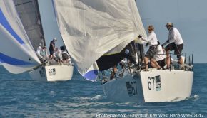
Quantum Key West 2014 hosts 123 teams competing for a full week (Jan. 20-24) in Key West, FL. Located at the southernmost tip of the continental United States, and just 90 miles from Cuba, having a handle on the weather is a challenge and a key to success at this elite event. Here is the weather forecast prepared by Sailing Weather Service issued 0705 LT January 23, 2014…
WARNINGS AND ADVISORIES: There are no active warnings or advisories in the course area this morning. Conditions can change quickly. Please monitor NOAA All Hazards Radio on your VHF for the latest official warnings and advisories from The National Weather Service.
SYNOPSIS: Yesterday, strong winds in the early morning moderated more quickly than expected, with some holes under 15 knots developing as early as mid-day. Gradients weakened earlier than forecast. The direction behaved about as expected. For today, veering gradient is expected to support a moderate NE winds most of the day. It will average a lighter than yesterday, but stronger winds are forecast to return tomorrow.
This morning’s weather map shows a weakening high pressure moving out of the FL Big Bend area and eastward where it will dissipate. An Arctic cold front lies just north of the Gulf coast and will move southeast into the northern Gulf this morning, and to the waters north of Key West (off Ft Myers) by this evening.

As the high moves east, the gradient will generally veer NNE/NE to NE today and possibly ENE this afternoon. The gradient strength is expected to hold relatively steady throughout the day. Winds are expected to reflect the gradient behavior closely. Given the direction will flow off the keys which will warmed under daytime sun, some mixing and instability in the wind may evolve, especially from mid-day through mid-afternoon.
CURRENT CONDITIONS: NE winds are generally in the 10-15 kts range this morning. There haven’t been any significant trends in the breeze in the last few hours. It is fairly steady.
Both satellite and radar confirm clear conditions across the lower keys and windward areas.
FORECAST DISCUSSION: NE 11-16 knots at first this morning. A modest build 12-17 is forecast mid-morning. Then tending NE/ENE and easing late-morning through early afternoon 10-14 kts. Some holes under 10 are possible at times through the afternoon, with a general easing ENE 8-13 kts possible latter half of the afternoon.
WEATHER: Mainly sunny. A few minor cumulus may develop over the keys and move south or southwest into the course area this afternoon. An increase is cloud cover is possibly later this afternoon as the cold front approaches from the north.
TEMPERATURE: Cool mid-50sF this morning, warming to upper-60sF this afternoon.
SEAS: Waves generally dominated by wind chop, around 1 ft close to Key West and 2 ft further offshore. Chop may increase modestly if wind veers more ENE.
Detailed Wind Forecast:
Time Wind Speed Wind Direction (MAG)
(LT) Mean Range Mean Range
0800 13 11-16 050 035-065
0900 14 12-17 050 040-065
1000 14 11-16 055 040-070
1100 13 11-15 055 040-070
1200 12 10-15 060 045-070
1300 11 09-14 060 045-075
1400 12 10-14 065 050-075
1500 13 11-15 065 050-080
1600 12 10-15 070 055-080
1700 12 10-14 070 055-080
1800 12 10-14 070 055-080
HEDGE: FORECAST CONFIDENCE: AVERAGE
1) The models are in VERY close agreement on the forecast scenario today, both direction and speed. The models vary across a 1-3 kt speed range and all show a modest right trend to the direction. Give the good agreement between models and recent observations, and the consistency among the model forecast, I stayed close to the model consensus in developing the forecast table for today.
2) A modest increase is the wind is possible through mid-morning. Perhaps a just a bit more gusty for a time. By starting time, winds should be easing slightly, but still holding mainly in the low or middle teens. A right trend from NE to NE/ENE is possible with this veering trend.
3) The forecast table depicts a slow but persistent right trend through the day. While confidence is high, the persistent trend may play less of a role than general oscillating shifts. The turbulence of air flowing over the keys will create more random shift and puff/lull behavior.
4) The further right the wind gets (ENE), the steadier and slightly stronger the wind should be on the offshore (right) side of the course area. More patchy and unstable breezes can be expected on the inshore (left side), especially for the eastern course area and closer to Key West.
5) There is a chance that winds will be lighter than forecast, especially this afternoon. Be ready for some holes of breeze well under 10 at times.
6) Sunny conditions are expected, but a few thermal cumulus may develop over the keys and drift south or southwest. Watch for very light/patchy conditions under any clouds that drift into the course area.
***************************************************************
OUTLOOK FOR FRIDAY (24 January 2014)
After a cold front moves south across Key West just before or around sunrise tomorrow, a solid N/NNE wind is expected to fill after sunrise, peaking in the late morning through mid-day period. Mainly fresh winds are expected, support by high pressure building into the northern Gulf in the wake of the front. Some strong gusts are also possible up to 30 kts, especially through about mid-day. Winds then easing and veering slightly through the afternoon.
Detailed Wind Forecast:
Time Wind Speed Wind Direction (MAG)
(LT) Mean Range Mean Range
0800 19 16-23 010 360-025
1000 22 19-25 015 360-030
1200 21 19-24 020 005-030
1400 20 18-22 020 005-035
1600 19 17-21 025 010-035
1800 18 16-21 030 015-040
SEAS: 1-3 ft in the morning increasing moderately rough 2-4 ft except up to 5 ft on the southern boundary of the racing area.
TEMPERATURE RANGE: Mid 50sF warming to mid-60sF.
WEATHER: Some morning cloud and perhaps even a brief, light shower. Then clearing to scattered clouds for most of the day.

Related Posts

Six hours with Ken Legler →

Pics or it didn’t happen →
Drunk man steals tiki hut bar →