As bad as it can get for Florida
Published on September 8th, 2017
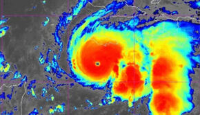
Senior Marine Meteorologist Lee Chesneau submits this assessment on Hurricane Irma.
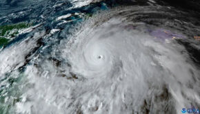
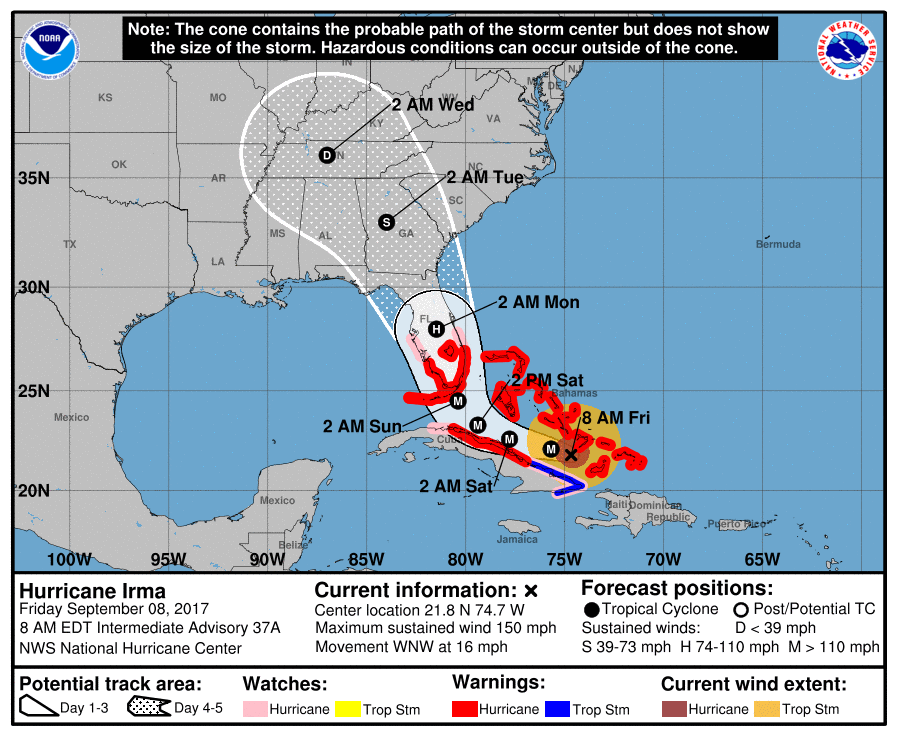
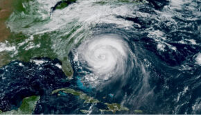
(September 8, 2017; 6:32am PT) – The worst possible scenario that could be for a hurricane to impact Florida is unfolding: an African born tropical system crossing the entire tropical Atlantic Ocean basin with no major land obstruction such as mountainous Cuba, heading into water temperatures approaching 90 degrees, fueled by even the warmer Gulf Stream/Florida Current.
All this is occurring before landfall which will be anywhere from Homestead/Miami to Palm Beach. To make matters worse…Irma’s track will likely take the storm through the entire length of the Florida Peninsula…there can be no over hyping this one-eyed cyclops.
Between 15 to 20 foot storm surge, winds in excess of 150 knots, chaotic seas whose heights Hollywood could not replicate, will be of epic proportions. “Here by the grace of God go I,” applies to every living being in harms way. The power of Mother Nature is not open for debate!!


Related Posts
Good news for Atlantic hurricane season →
Three places overdue for hurricane →
Limitations of the Saffir-Simpson scale →