Major hurricane to hit U.S. gulf coast
Published on August 25th, 2020
(August 25, 2020) – When forecasters with NOAA’s Climate Prediction Center, a division of the National Weather Service, released its annual August update to the Atlantic Hurricane Season Outlook, it detailed how the 2020 season had been off to a rapid pace with the potential to be one of the busiest on record.
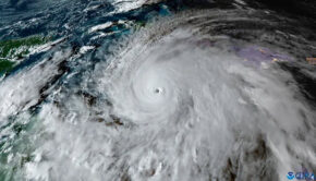
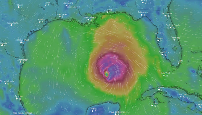
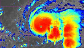
At that point, damage had been limited, but that appears to soon change when Hurricane Laura makes landfall as a major hurricane, with winds of around 115 mph and a storm surge up to 13 feet, landing near the Louisiana-Texas border late Wednesday or early Thursday (Aug. 26-27), according to the National Hurricane Center.
The storm surge estimates are “staggering amounts, life-threatening amounts,” NHC Director Ken Graham said.
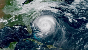
Laura was declared a hurricane this morning, when a NOAA hurricane hunter aircraft detected maximum sustained winds of 75 mph as the storm’s center was crossing into the Gulf of Mexico. It’s expected to draw more power from the Gulf’s warm waters.

“Significant strengthening is forecast during the next 48 hours,” NHC forecaster Eric Blake said in his advisory.
Laura is expected to become a Category 3 storm, which routinely cause “devastating damage” to homes, trees and infrastructure, according to the National Weather Service. Recent Category 3 storms include Harvey, which hit Texas in 2017, and Rita, which hit Louisiana in 2005.
A hurricane warning is now in effect from San Luis Pass, Texas — just south of Galveston — to Intracoastal City, La., meaning hurricane conditions are expected somewhere within the warning area, likely within 36 hours.
The weather agency issued a storm surge warning for an even wider area, from San Luis Pass to the mouth of the Mississippi River.
Source: NPR

Related Posts
Good news for Atlantic hurricane season →

Three places overdue for hurricane →
Limitations of the Saffir-Simpson scale →