Weather Forecasting: Thunderstorms and Squalls
Published on August 12th, 2015
by Stan Honey and Ken Campbell
There are three types of squalls/thunderstorms: those associated with a cold front or low pressure area, the “air mass” thunderstorm, and trade wind squalls.
Cold front thunderstorms develop along the leading edge of a cold front. Remember, the cold front brings a wind shift from the south or southwest into the west and northwest. The cold front also brings a change in temperature and increased dryness of the air. Thunderstorms develop vertically into the atmosphere, reaching heights of 40,000-50,000 feet. The rule of thumb is the taller the thunderstorm, the more violent the weather will be. Taller, more violent thunderstorms will be preceded by an area of high clouds that spread out from the top of the thunderstorm, moving with the jet stream. Since these higher clouds appear overhead before the thunderstorms arrive in your area, they will give you an early warning signal of an approaching squall line.
When thunderstorms develop up in to the jet stream level – which moves faster than the cold front – they will move out in front of the cold front. Thunderstorms can precede the cold front by several hours. If this happens, there will be a weather lull between the squall line and actual cold front. But if the lull lasts for more than three to four hours, there could be a second squall line closer to the actual cold front.
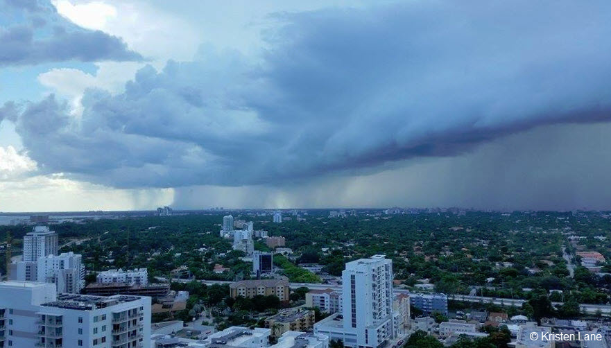
Air mass thunderstorms form inland during the afternoon and move very little. During late afternoon and evening, when the afternoon sea breeze weakens and ends, thunderstorms will move towards the shoreline. If the thunderstorms persist long enough, they can bring squally weather to the coast around and after sunset. The Florida coast, parts of the Central American coast, Africa, and Brazil are notorious for the late afternoon and evening squally thunderstorms, especially during the summer seasons.

Trade wind squalls are typically smaller, less developed, and less violent than thunderstorms. A simple rule of thumb is: the taller the cloud, the stronger the squall will be. They generally move from east to west in both hemispheres. They are strongest two to three hours before sunrise. They are weakest from late morning thru mid – afternoon. Mid-morning showers can cause very large areas with very little wind. Squalls that form around or just after sunset can also be gusty.
This resource is provided by the US Sailing Safety at Sea Committee. Read the entire chapter on Weather Forecasting and Waves by Stan Honey and Ken Campbell.
Learn more about US Sailing Safety at Sea Seminars in your area.

Related Posts
How would you decide this? →

Lessons from 1,000 miles of ocean racing →

Suffering for short moments of great fun →