
Predictions for Hurricane Matthew
Published on October 2nd, 2016
(October 2, 2016; 12:40 PM ET) – Hurricane Matthew will impact the U.S. East Coast later this week, but how close it tracks and its strength will determine the severity of the impacts.
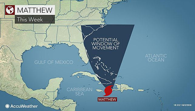
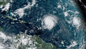
Matthew, currently a powerful Category 4 hurricane in the Caribbean, will bring devastating wind, surge, rain and mudslides to Haiti, eastern Cuba and Jamaica Sunday night into Tuesday (Oct 2-4). It will then take aim at the Bahamas and Turks and Caicos through Wednesday.
Beyond that, uncertainty greatly increases in the track, timing and intensity of Matthew. There are several scenarios that could play out which would result in different threats for the U.S. East Coast. As Matthew emerges from the Bahamas around midweek, the U.S. East Coast will need to be on alert.
While the exact track is unknown at this time, Matthew could take a track close to the coast or could pass several hundred miles offshore. Regardless, the U.S. East Coast will still face impacts. AccuWeather Meteorologists expect Matthew to still be a powerful hurricane at midweek as it churns over warm water near the Bahamas.

“At the very least, rough surf and rip currents should impact the East Coast,” AccuWeather Meteorologist Evan Duffey said.
The largest waves will likely batter Florida to North Carolina Wednesday through Friday (Oct. 5-7). Rip currents will develop and can be life-threatening, so vacationers and beachgoers should heed local swimming advisories. Beaches will likely experience some erosion as the waves repeatedly batter the coast. Some areas could also experience coastal flooding.
Depending on where Matthew goes after Friday, rough surf could batter coastal areas farther north from Virginia to southern New England. A scenario in which Matthew brushes the East Coast or makes landfall is still on the table. There will be several key factors in determining which way Matthew is steered later in the week and they will have large implications on whether or not Matthew strikes the East Coast.
Initially, Matthew will emerge out of the Caribbean as it tracks northward between an area of high pressure over the Atlantic and a dip in the jet stream over the eastern U.S. and Gulf of Mexico, according to AccuWeather Meteorologist Mike Doll. Where exactly this atmosphere highway sets up between these two features will determine how close Matthew comes to Florida.
The next key weather system will likely be a storm system set to track into the central U.S. by Tuesday. “If that system is slower to reach the eastern U.S., the chance that Matthew hits the Carolinas is greater,” Doll said.
If the track were to track close to the coast, significant impacts from rain, wind and flooding would be possible. “If the system is faster, it could then pick up Matthew and kick it out to sea,” Doll said.
Even in this scenario, Matthew may still impact a smaller part of the East Coast before getting steered away. It is also possible that Matthew initially gets pushed away from the coast, but then gets drawn back into New England or the Maritime Provinces of Canada. “The key message is that we cannot rule out a direct impact along the East Coast,” Doll said. “However, confidence is high that Matthew will not track into the Gulf of Mexico.”
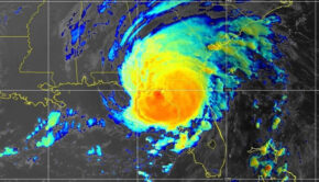
Matthew will have plenty of warm water and a favorable environment to work with later this week off the Southeast coast. “What is clear is that Matthew should remain a powerful system all the way up until and even beyond transitioning to an extra tropical cyclone,” Duffey said.
At this point, it is too early to rule out any possibilities with Matthew later in the week. Once Matthew passes Cuba and into the Bahamas, there should be some clarity with where Matthew may track.
Until then, residents and vacationers from Florida to New England and even the Canadian Maritimes should keep a watchful eye on Matthew.
Source: AccuWeather

Related Posts
Is your name on the 2024 storm list? →
Are alarm bells beginning to go off? →
‘Extremely active’ 2024 hurricane season →

 We’ll keep your information safe.