2016 Atlantic Hurricane Season Debrief
Published on December 2nd, 2016
The six-month 2016 Atlantic hurricane season, which annually extends from June 1 to November 30, had the most storms since 2010 and was the first season that saw more storms than normal since 2012.
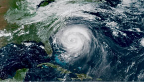
The most memorable storm was deadly and devastating Hurricane Matthew, which left hundreds dead in Haiti and led to horrendous flooding in the Carolinas after spinning up the U.S. East Coast.
The season was an unusually long one as well, starting with bizarre Hurricane Alex in January and ending with Hurricane Otto, which made a rare Thanksgiving landfall in Central America.
In all, a total of 15 named tropical storms formed during 2016, seven of which turned into hurricanes (Alex, Earl, Gaston, Hermine, Matthew, Nicole and Otto), according to the National Oceanic and Atmospheric Administration.

A normal season sees 12 named storms, six of which become hurricanes.
Three of the hurricanes in 2016 were classified as major hurricanes (Gaston, Matthew and Nicole), meaning they reached Category 3 strength with wind speeds of 111 mph or higher. None of those storms hit the U.S. as a major hurricane however, extending the nation’s record streak to 11 years since the most recent major hurricane (Wilma) made landfall.
The U.S. has never had another 11-year period without a major hurricane landfall since records began in 1851, according to Colorado State University.
Five named storms hit the U.S. during 2016, the most since 2008 when six storms struck.
Notable storms
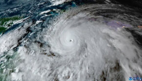
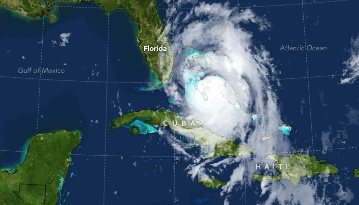
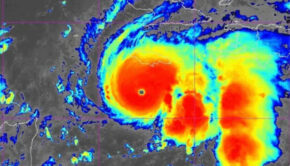
The strongest and longest-lived storm of the season was Matthew, which had winds of 160 mph and lasted as a major hurricane for eight days from Sept. 30 to Oct. 7. Matthew was the first category 5 hurricane in the Atlantic since Felix in 2007.
The storm was a humanitarian disaster in Haiti, where it killed at least 500 people and perhaps as many as 1,000, according to local officials.
Matthew killed 49 people in the U.S.
Unusually early Alex formed on Jan. 13, spun through the Azores as a Category 1 hurricane and tropical storm, then dissipated on Jan. 15. It was the first Atlantic hurricane that formed in January since 1938, the Weather Channel said.
Hurricane Hermine made a 4,000-mile journey across the Atlantic before making landfall in the Big Bend of Florida on Sept. 2, ending the state’s record-long hurricane drought at 3,966 days.
Otto’s hurricane landfall was the latest in any calendar year on record in the Atlantic Basin, according to meteorologist Phil Klotzbach of Colorado State University.
The eastern and central Pacific Oceans also saw above-normal activity in 2016.
Predictions
Top forecasters slightly underestimated the final total: Colorado State University called for 13 tropical storms, of which six would become hurricanes. NOAA predicted that 10-16 tropical storms would form, and four to eight would become hurricanes.
AccuWeather and The Weather Channel, two of the largest private weather forecasting companies, both predicted 14 named tropical storms would form, and eight would become hurricanes.
One reason for the busier than normal season was, unlike 2014 and 2015, wind shear levels (the change in wind direction with height) were somewhat below average, due in large part to the absence of El Niño, according to Klotzbach.
Source: USA Today

Related Posts
Good news for Atlantic hurricane season →

Three places overdue for hurricane →
Limitations of the Saffir-Simpson scale →