
Conditions Unfavorable For Atlantic Storms
Published on August 2nd, 2018
by Dennis Mersereau, Forbes
The clock is ticking toward the peak of the Atlantic hurricane season. We’re just about a month away from what’s historically the most active part of the season. So far, aside from two quick storms early in July, the Atlantic has been fairly quiet. Silence breeds complacency, though, and as we found out in previous years, things can change for coastal residents in a hurry.
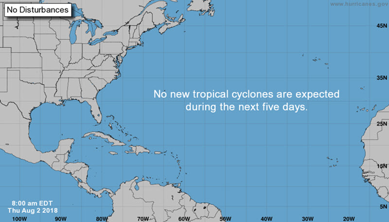
However, conditions over the Atlantic Ocean are so inhospitable that the weather models aren’t even spitting out any ‘phantom’ hurricanes. The GFS (American) weather model has a nasty habit of spinning up hurricanes in the long-range that never come to pass. These false storms can sometimes signal the potential for development later on, but they’re usually just quirks in model fantasyland.
Even though we’re in prime season for these fake hurricanes to show up on the weather models, conditions are too unfavorable for even the weather model’s imagination to get one to develop.
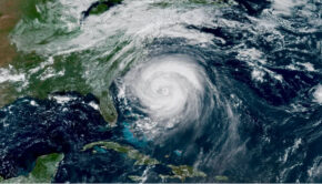
We saw two hurricanes in the Atlantic in July. The first storm, Beryl, formed into a hurricane against all odds. The storm was remarkably tiny—only a few dozen miles across—but its small size allowed the storm to take advantage of the right conditions in just the right spot in order to spin itself up into a hurricane. Hurricane Chris formed around the same time as Beryl, meandering over the Gulf Stream for a week before swirling out to sea.

Other than those two named storms, we’re dealing with pretty much the same conditions that greeted the month of July. A strong Bermuda High over the western Atlantic is currently pumping muggy air over the East Coast. That same high is producing strong subsidence over the western Atlantic, stifling any chance for storm activity under its influence.
Wind shear over the western Atlantic and Caribbean is still unfavorable for tropical development. Strong wind shear disrupts thunderstorms that serve as the nucleus for a tropical cyclone; without the thunderstorm, there is no cyclone.
The ocean is also a few degrees cooler than normal between the Caribbean and Africa. While the water is warm enough for tropical development, below-average sea surface temperatures aren’t conducive to steady storm development.
There have also been persistent bursts of dry air moving over the ocean from the Sahara Desert. We’ve seen plenty of African dust storms reach the southern United States over the past few weeks, bringing hazy skies and poor air quality to places like Texas. Saharan air is dry, and dry air puts a lid on thunderstorms that could grow into tropical cyclones.
We won’t reach the peak of the season until September, and even the quietest years tend to cough up a couple of storms before the autumn air takes hold. This lull in the lead-up to peak season is a good opportunity to take stock of emergency supplies and create a plan for what to do in case a storm threatens.
Even if we wind up without any storm threats this year, it’s better to know what to do in case of a storm than rush when one turns toward land. Plus, having emergency supplies on hand is always a good idea in the event the power goes out during one of those nasty afternoon thunderstorms.
Source: www.forbes.com

Related Posts
Good news for Atlantic hurricane season →
Three places overdue for hurricane →
Limitations of the Saffir-Simpson scale →