Better Tools for 2017 Storm Season
Published on March 12th, 2017
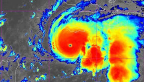
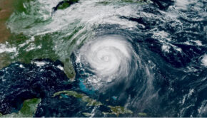
When the Atlantic and Pacific Hurricane seasons officially begin this spring, the National Oceanic and Atmospheric Administration have revealed new or recent changes to their National Hurricane Center products that will provide more accurate and detailed information for 2017.
1) Storm Surge Watch/Warning becomes operational
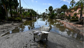
Beginning with the 2017 hurricane season, the National Weather Service (NWS) will issue storm surge watches and warnings to highlight areas along the Gulf and Atlantic coasts of the continental United States that have a significant risk of life- threatening inundation from a tropical cyclone, subtropical cyclone, post -tropical cyclone, or (pending final NWS approval) a potential tropical cyclone. Storm surge is often the greatest threat to life and property from a tropical cyclone, and it doesn’t always occur at the same times or locations as a storm’s hazardous winds.
2) Issuance of Watches, Warnings, and Advisories for Potential Tropical Cyclones
Pending final NWS approval, NHC will in 2017 have the option to issue advisories, watches, and warnings for disturbances that are not yet a tropical cyclone, but which pose the threat of bringing tropical storm or hurricane conditions to land areas within 48 hours. Under previous longstanding NWS policy, it has not been permitted to issue a hurricane or tropical storm watch or warning until after a tropical cyclone had formed. Advances in forecasting over the past decade or so, however, now allow the confident prediction of tropical cyclone impacts while these systems are still in the developmental stage.
3) Experimental Time of Arrival of Tropical-Storm-Force Winds Graphic
The arrival of sustained tropical-storm-force winds is a critical planning threshold for coastal communities, as many preparedness activities become difficult or dangerous once winds reach tropical storm force. Frequently, this timing is estimated using the deterministic NHC track, intensity, and wind-field (size) forecasts, but such an approach doesn’t account for forecast uncertainty, and communities can be caught off guard if a storm speeds up or grows in size beyond what was forecast. To provide guidance on when users should consider having their preparations completed before a storm, NHC will begin issuing in 2017 experimental Time of Arrival of Tropical-Storm-Force Winds graphics.

4) Update to tropical cyclone advisory graphical products
The NHC has updated the look of its tropical cyclone advisory graphics. The suite now has a consistent look across the various graphics, with cleaner fonts and softer colors. One significant enhancement is the addition of the current extent of hurricane- and tropical-storm-force winds to the cone graphic, which will help illustrate that hazardous conditions can occur well outside of the track forecast cone. In addition, a set of radio buttons will allow users to toggle on and off various elements of the cone graphic.
5) Annual update to the track forecast error cone
The size of the tropical cyclone track forecast error cone for both the Atlantic basin and the eastern Pacific basin will be smaller this year. The cone represents the probable track of the center of a tropical cyclone, and is formed by enclosing the area swept out by a s et of imaginary circles placed along the forecast track (at 12, 24, 36 hours, etc.). The size of each circle is set so that two -thirds of historical official forecast errors over the previous five years (2012-2016) fall within the circle.
For full detail on above changes, along with additional changes, click here.

Related Posts

End-of-life boat collection →
Good news for Atlantic hurricane season →
Three places overdue for hurricane →